


maps
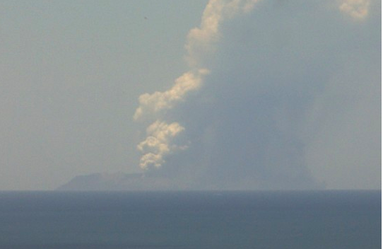
White Island / Whakaari erupts (+Wind Maps for ash clouds)
BREAKING NEWS — UPDATED 5:49pm — White Island in New Zealand’s Bay of Plenty region has erupted this afternoon with a significant plume seen from land. NZ news media outlets are reporting there have been injuries on the island. The volcano can be seen erupting on webcam via GeoNet here. WeatherWatch.co.nz says winds are fairly light …
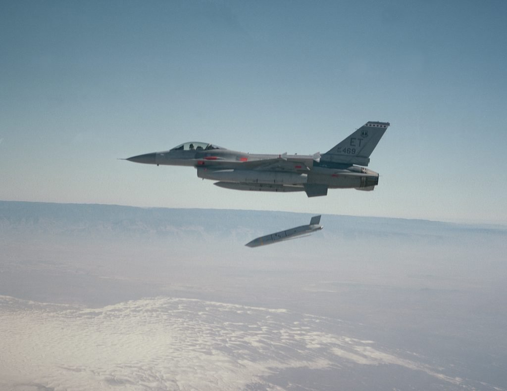
Special Ops Using Army’s Prototype 3D Maps On Missions: Gervais « Breaking Defense
An early version of One World Terrain, the Army’s attempt at a 3D digital world map detailed enough for training simulations and mission planning. WASHINGTON: The Army’s One World Terrain software was intended to build 3D battle maps for training simulations. But an early version has already proven so useful that special operators are using it …
How to use Google Maps Detailed Voice Guidance
Yesterday, we wrote about how Google is adding a new visual accessibility tool to Chrome. In honor of World Sight Day, Google continues to champion tech accessibility with its latest addition to Google Maps: a “Detailed Voice Guidance” feature that makes it easier for the blind and visually impaired to navigate on foot. Here’s how …
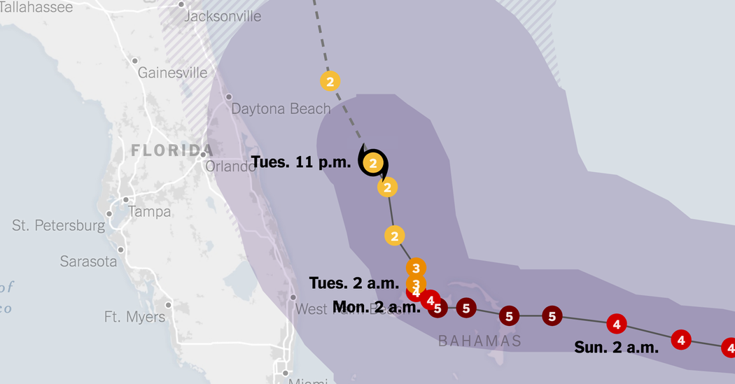
Maps: Track Hurricane Dorian’s Path
Hurricane Dorian was downgraded to a Category 2 storm on Tuesday, after it battered the Bahamas and forecasters continued to warn of severe hurricane conditions across Florida and the southeastern coast of the United States. 5 >156 m.p.h. 4 130-156 m.p.h. 3 111-129 m.p.h. 2 96-110 m.p.h. 1 74-95 m.p.h. Tropical storm Note: Areas shown …
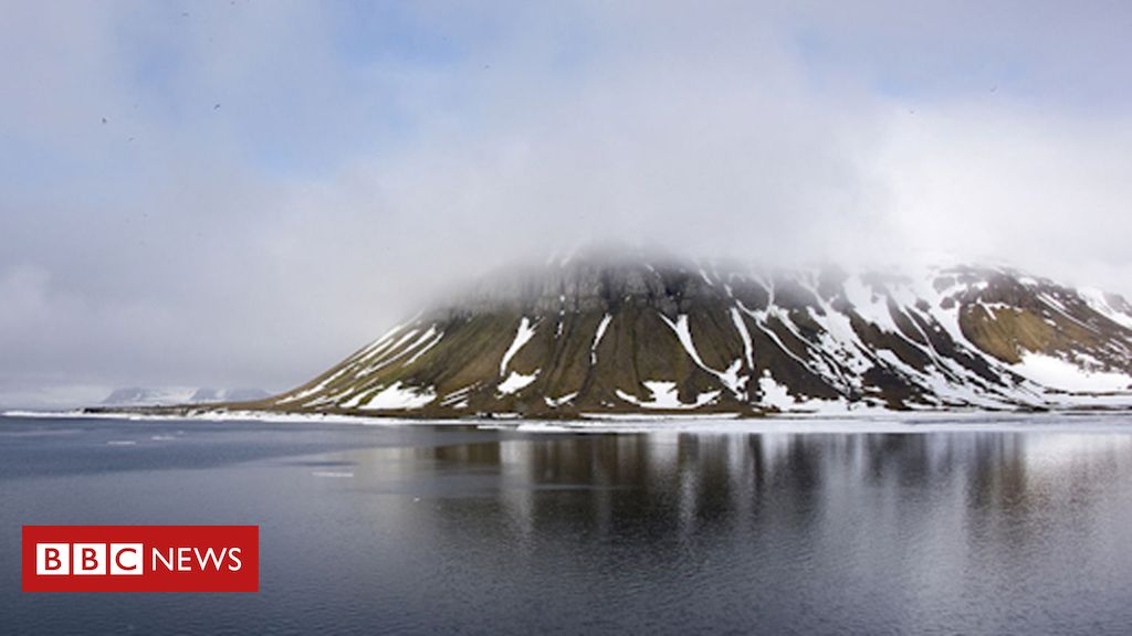
Arctic team maps five islands found by Russian student
Image copyright Mil.ru Image caption Novaya Zemlya: There is still uncharted territory in Russia’s vast Arctic north A Russian Arctic expedition has mapped five small islands in the far north, discovered by a student analysing a glacier’s retreat in satellite photos. Before Marina Migunova’s discovery in 2016 the islands were hidden under the Nansen Glacier, …
Google Maps AR Navigation comes to iPhones and Android devices
Google Maps is finally rolling out its augmented reality walking navigation to a wider audience. The feature was announced at Google I/O 2018 (yes, ’18), entered private testing in February, and launched for Pixel phones at Google I/O 2019. Now, regular people will have access to AR navigation, as the feature is launching in beta on …
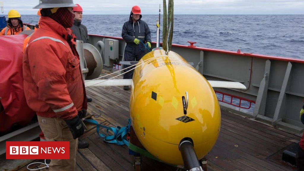
‘Boaty McBoatface’ maps deep ocean water
Image copyright P.Abrahamsen/BAS Image caption The expedition was the new sub’s first major scientific outing Intrepid submarine Boaty McBoatface has made its first significant discovery, say UK scientists. The autonomous underwater vehicle (AUV) has built a 3D map of deep ocean waters as they move away from Antarctica. Researchers previously had limited data to show …
New technology maps threatened coral reefs – News – The Columbus Dispatch
Coral reefs make up just 1% of the ocean floor yet they are home to 25% of the world’s marine fish, a growing source of protein for people. But reefs are imperiled by a range of threats including warming waters, acidifying seas, destructive fishing methods, and agricultural and other runoff. Moreover, scientists have only a …
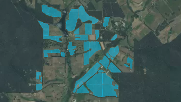
Wine industry toasts technology behind new national vineyard scan – ABC Rural
High-tech mapping, using artificial intelligence and satellite imagery, has revealed that nearly half-a-million kilometres of grape vines are growing throughout Australia. Funded by Wine Australia, the National Vineyard Scan determined the location and density of plantings, detecting a total of 463,718 kilometres of vine. To put that into perspective, the distance between Earth and the …
Google Maps is testing a new safety feature for taxi passengers
Google appears to be testing a new safety feature for Google Maps that will alert you if your car or taxi deviates from its route by more than 500 meters (0.3 miles). The feature was first spotted by XDA Developers, and it appears to be exclusive to India for now. “Off-route alerts” can be found …