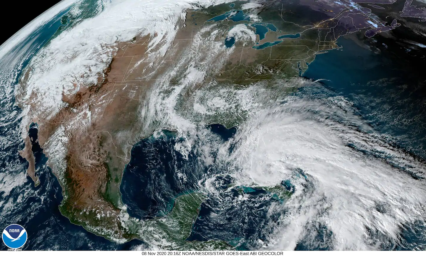
This means that heavy rains and strong winds will be prolonged in many parts of the state, and coastal flooding will last for many high-tide cycles.
The storm’s swipe at Florida is part of the second incarnation of Eta, which killed dozens in Central America last week after striking Nicaragua on Tuesday as a devastating Category 4 storm.
Here are the watches and warnings in effect for Florida:
- A hurricane warning along with a storm surge warning is in effect for the Florida Keys from Ocean Reef to the Dry Tortugas, including Florida Bay.
- A hurricane watch is in effect from Golden Beach to Bonita Beach.
- Tropical storm warnings are up for both coasts of southern and central Florida from the Brevard-Volusia County line to Englewood, or roughly between Daytona Beach and just north of Fort Myers. That includes places such as Fort Lauderdale, Miami, West Palm Beach, Naples and Lake Okeechobee.
- “Hurricane conditions are expected in portions of the Florida Keys by early Monday,” the National Hurricane Center stated in an online forecast discussion.
- Flood watches are in effect ahead of Eta, too, with the National Weather Service singling out “flash and urban flooding” as a significant threat. The Weather Service is projecting as much as a foot and a half of rain for parts of the central and southern Florida peninsula.
- A storm surge watch is also in effect for a vast stretch of the state’s coastline, from Bonita Beach to Card Sound Bridge.
- Areas, including Miami, could see “a dangerous storm surge” of two to four feet of above normal tide levels, according to the National Hurricane Center.
Tracking Eta
At 4 p.m. Sunday, Tropical Storm Eta was located north of central Cuba, over the warm waters of the Florida Straits, with maximum sustained winds of 65 mph. The storm was moving northwest at 14 mph.
On satellite, Eta had more thunderstorms on its eastern half than in its western reaches, making it appear “lopsided,” the Hurricane Center stated. But tropical storm conditions are occurring in South Florida, as the storm has an expansive wind field and shows some signs of intensifying.
Eta will move over the warm ocean waters of the Florida Straits by Sunday evening, regaining some of its intensity as it slowly churns north and eventually northwest. The Hurricane Center is forecasting to reach hurricane intensity, with peak sustained winds likely to be near 75 mph Monday morning.
Heavy rainfall may be Eta’s biggest threat
Eta was already producing heavy rains across much of South Florida on Sunday morning, with downpours sweeping west across the state as far as Sarasota. Doppler radar estimated that as much as 5.5 inches had fallen just west of Fort Lauderdale as of Sunday morning. That matched with a 24-hour rainfall total of 5.5 inches already reported in Broward County near the town of Sunrise. A flood warning was in effect for Miami on Sunday afternoon due to between 2 to 5 inches of rain having fallen, with more to come.
The Weather Service is forecasting a widespread “6 to 12 inches of [additional] rainfall … possible over South Florida through Tuesday.” The Hurricane Center says that could put a few isolated locations up near 18 inches by the time the storm is done with the Florida Peninsula.
The heaviest rain looks to fall late Sunday through Monday, especially near and east of Eta’s track, while the storm’s center passes just west of the Keys. There could be coastal enhancement of rainfall in southeast Florida, where a number of computer models simulate the bull’s eye of rain developing.
Flooding is a particular concern in South Florida, as the ground is already saturated there. Miami saw nearly a foot of rain in October while Key West picked up just under eight inches for the month, making additional heavy rainfall problematic.
“It will not take much additional rainfall to cause flooding in the region, especially over the east coast metropolitan areas,” wrote the Weather Service forecast office in Miami.
There are indications that a reinvigorated Eta could affect parts of the Florida Gulf Coast during the mid-to-late week time period, with still more heavy rains.
The wind threat
There was an increasing risk of damaging winds in South Florida beginning Sunday evening, according to the Hurricane Center, with winds approaching or reaching hurricane force in the Florida Keys. The Weather Service predicts gusts of 50 to 55 mph in the Miami to Homestead corridor — with the strongest occurring from Sunday night into Monday — with a few 60 mph gusts mixed in on Florida’s southernmost coast.
Already, a wind gust to 53 mph was observed at Palm Beach International Airport early Sunday afternoon.
Sustained winds of 75 mph are forecast in the lower Florida Keys if Eta intensifies as predicted while moving over the low-lying island chain overnight into Monday.
If the storm tracks farther north, the core of strongest wind gusts would shift closer to the Miami metro area.
Storm surge flooding
Storm surge flooding poses a particular threat to the low-lying Florida Keys, where two to four feet of water above normal tide levels is projected. Since the islands are situated near sea level, any surge can cause flooded beaches, roadways, homes and businesses. Similar levels of surge are expected in southeastern Florida, including the Miami area, and southwestern parts of the state, to the south of Bonita Beach.
Isolated tornadoes
A few tornadoes can’t be ruled out to the right of Eta’s center, particularly in the spiral rain bands that will pivot onshore in southeast Florida and the Keys during most of Sunday and Monday. The Storm Prediction Center has included those areas in a level 1 out of 5 “marginal risk” of severe weather to account for this potential.
Though changing winds with height favor spinning storms, the amount of instability, or energy for air to rise, will be borderline. Therefore, any tornado activity should be isolated.


