


MADISON (WKOW) – The hottest conditions of the year are expected this week.
METEOROLOGICAL SPRING RECAP
For record-keeping purposes, March through May are grouped together as the spring months. Recapping that time period, temps and precipitation were slightly above average.
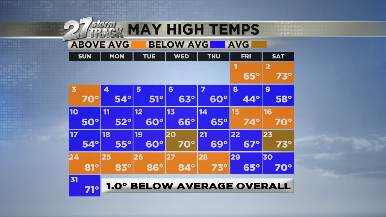
However, May was overall cool with temps a degree below average.
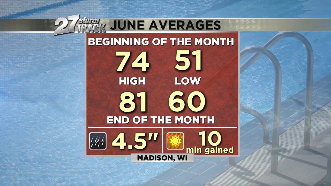
Average highs to start June are in the mid 70s and by the end of the month, they’ll be in the low 80s.
FORECAST
A warm front passes through our region today bringing a few showers, mainly this morning.
Rain chances taper this afternoon with some sunshine returning and causing temps to jump to the upper 70s with a breeze out of the SSW at 10-15 mph with gusts as high as 30 mph.
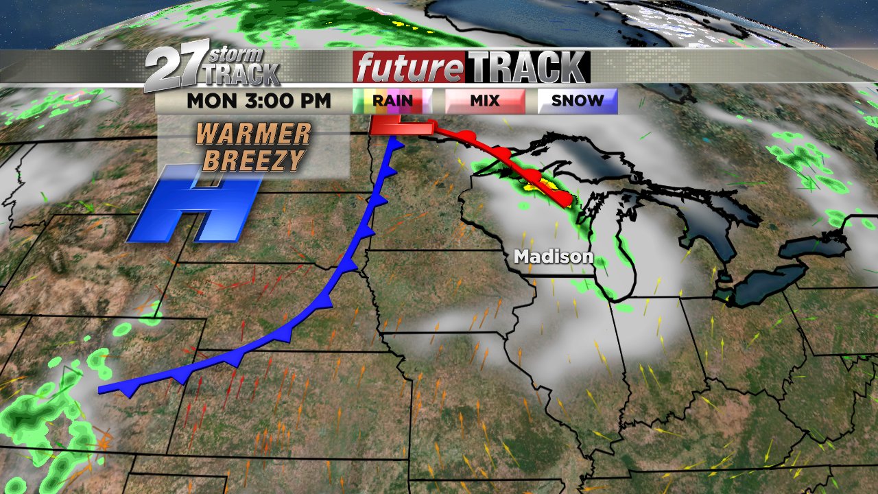
Partly to mostly clear tonight and muggy in the mid to upper 60s.
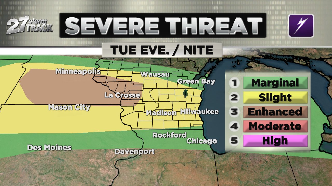
The heat expands on Tuesday with highs around 90°. That’ll make it the warmest day of the year so far. It’s also near a record. 91° is the record for that date set back in 1948.

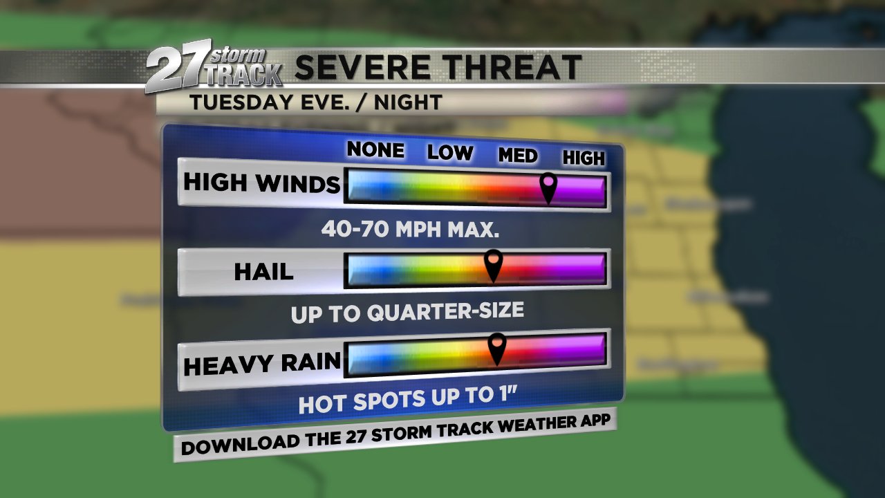
Strong to severe storms will develop late Tuesday evening with high winds and heavy downpours the main concerns.


