


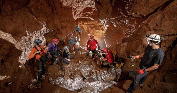
The explorers and film crew of Nat Geo’s Drain the Oceans explore the Tham Luang caves for a special episode–Drain the Oceans: Thai Cave Rescue.
National Geographic
Unless you were living off the grid in a cabin in The Rockies somewhere in the summer of 2018, you are probably familiar with the dramatic rescue of 12 boys and their soccer coach from the Tham Luang cave system in Thailand. The rescue took weeks of planning and careful consideration that left many wondering what was so challenging. If the boys could just wander into the cave while hiking, why couldn’t rescuers just “wander in” and go get them? Nat Geo will explore that question on Monday, September 2 with a special episode of Drain the Oceans.
Drain the Oceans: Thai Cave Rescue
If you recall, the attention of the entire world was focused on the plight of the young boys and the heroic efforts to locate and save them. Billionaire genius Elon Musk—of Tesla and SpaceX fame—even sent a rescue submarine in an attempt to assist. Thankfully, all 12 boys and the coach were eventually rescued from the elaborate cave system.
Now, Nat Geo will reveal why it was such a challenging and harrowing rescue. Using advanced mapping and LiDAR technology, Nat Geo is able to digitally “drain” the water from the flooded cave system and provide a unique and enlightening perspective on the dilemma the rescuers faced.
Nat Geo worked with the authorities in Thailand’s Department of National Parks to send a team into Tham Luang to conduct the first digital 3D survey of the cave system. The team used a laser scanning system that emits 400,000 beams per second to record reflections from the cave walls, enabling them to map the 1.5 mile span between the mouth of the cave and the pocket where the boys and their coach found themselves trapped as muddy monsoon waters flooded the cave. The extraordinary effort to produce Drain the Oceans: Thai Cave Rescue is the result of 8.7 billion data points from nearly 400 scans throughout a 3-week survey. The team also captured every crack and fissure of the cave system with more than 7,000 photos.
A press release from Nat Geo explains, “Once stitched together in a compelling episode directed by Sophie Elwin Harris, the final 3D scan reveals with absolute clarity how the boys were cut off by rising floodwaters in a matter of hours while they explored the caves. Stripping away the fast-flowing water, which filled several passages, the scans reveal how narrow tunnels hampered rescue efforts; where the guide rope was perilously placed, leading to life-or-death loss of direction; and how much preparation was needed in placing air tanks throughout the caves to move the boys to safety.”
Revealing Underwater Mysteries with Technology
The Thai Cave Rescue episode is part of the second season of the Nat Geo series Drain the Oceans. The concept of the show is awesome. The Drain the Oceans team examines various historically significant events and maritime mysteries using science and technology to remove the water from the picture so the viewer can get a clearer understanding of the scenario that took place.
Drain the Oceans combines the latest scientific data from underwater scanning systems with state-of-the-art digital recreations to reveal underwater mysteries. Season 2 of Drain the Oceans deals with a variety of compelling stories aside from the Thai Cave Rescue, including Hitler’s plan to dominate the seas with killer battleships, the secrets of Loch Ness, and the effort to respond to the attack on Pearl Harbor by the Japanese and reclaim control of the Pacific.
Check out Drain the Oceans on Nat Geo, and mark your calendar for Monday, September 2 at 9pm Eastern / 8pm Central for the special episode—Drain the Oceans. Thai Cave Rescue.


